General Comments on Weirend.
Weirend is at the downstream end of the waters of Ross Angling Club. This is the recognised salmon fishery for Ross AC. This fishery was once frequented by famous salmon fisher Robert Pashley, also known as “The Wizard of the Wye”, and before the Club took over the fishing rights it was the Guy’s Hospital salmon fishery.
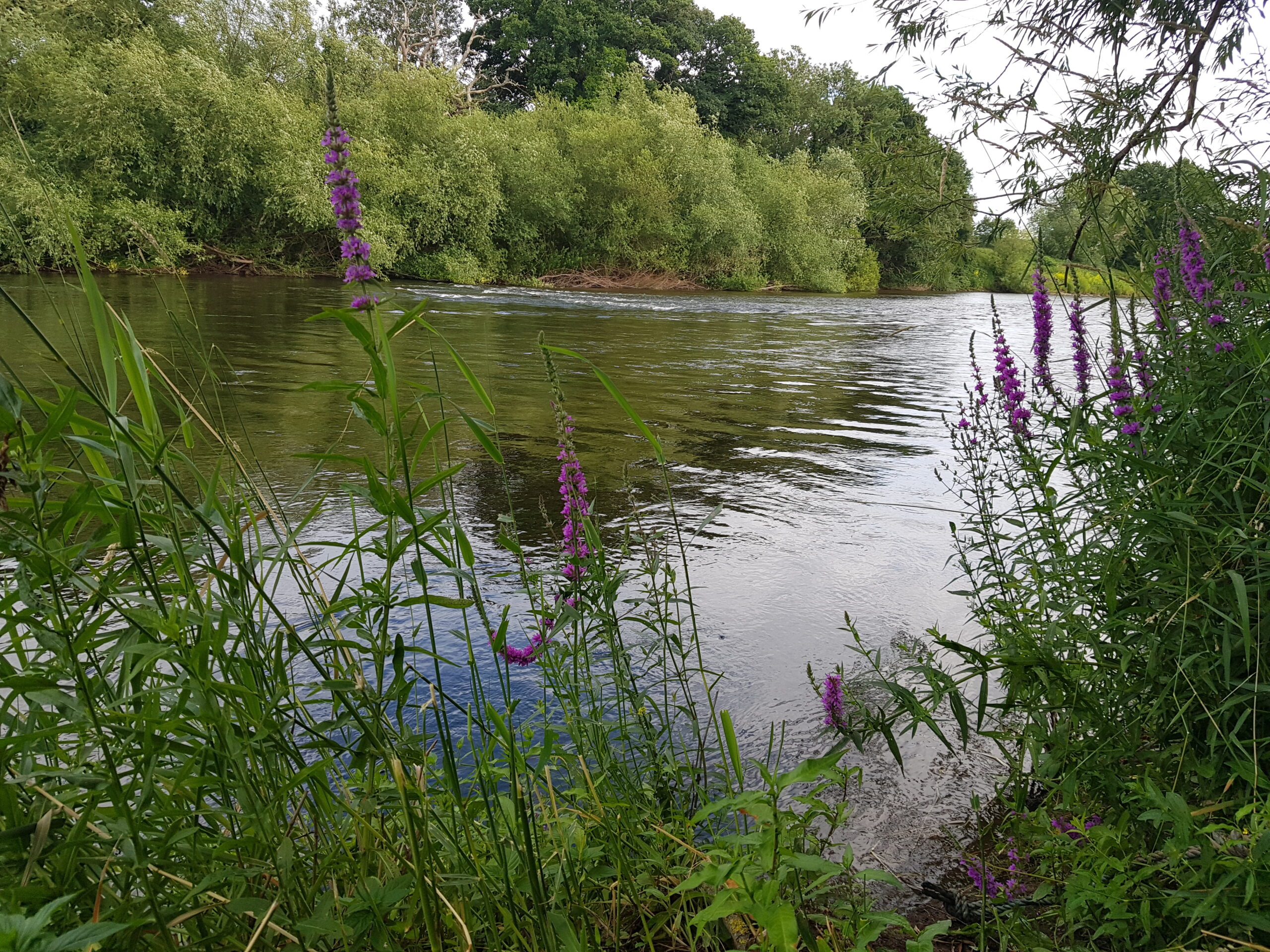
It is a mixture of waters from deep relatively slower moving sections of the River Wye to shallow runs over gravel and rock where the water is often only a few inches deep when the River is at normal levels. The stretch is approximately 2 miles in length and is marked at both ends with Club signs.
On this stretch is the Clubs salmon hut built by the Wye and Usk Foundation in their early days, where the member can sit awhile or make him/herself a cup of tea or coffee, a very pleasant spot in the spring sunshine. There is a gauge at the Salmon hut which matches the reading on the Environment Agency’s Ross gauge.
This stretch of fishing is entirely right bank, and both coarse and salmon members can fish the water. The salmon members have priority over the coarse members where the catches are marked by white post. On white post catches salmon anglers are permitted to fish through. In practice this hardly ever happens as coarse members infrequently fish downstream of the salmon hut where most of the white post catches lie. The coarse members of the Club tend to fish the deeper water upstream of the salmon hut so do not impact the salmon anglers at all.
All the catches on this stretch are also marked by name boards so that in the event of landing a salmon it is clear where it came from. There are several wooden benches in the stretch below the salmon hut for the convenience of the members.
Description of Weirend Fishery.
The Weirend fishery starts at the second meadow downstream from Wilton Bridge and the White Lion pub on the right bank and Club signs mark the start of our fishing as you go through the metal kissing gate after crossing the plank bridge following the riverside footpath. The first meadow is shallow for the most part with just a few short deeper channels before it deepens considerably as the Wye dives into the first of the deep water at Poachers hole. Here the bankside footpath goes through a second metal kissing gate into the most popular section for the coarse members. Downstream from Poachers Holes the River remains fairly deep at somewhere between 2 metres to perhaps 2.5 metres in places and passes two notable salmon catches at “The Stones” and “Brighton Rock”, neither of these are fly water but useful spinning water which have produced salmon in recent years.
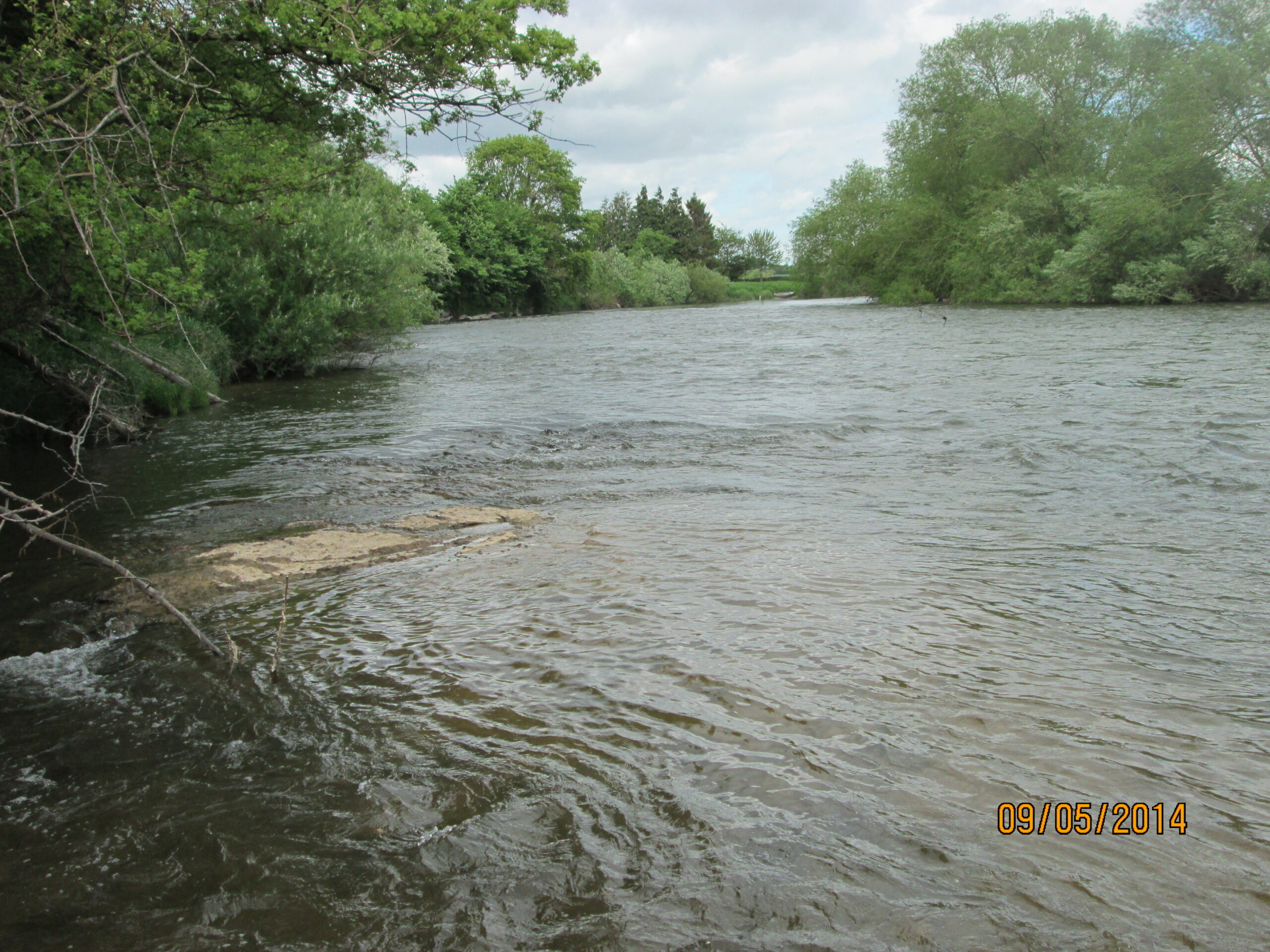
At the downstream end of this stretch is the Salmon Hut/ Weirend Crib where the water is wadable when the Ross Environment Agency gauge reads 0.5 metres or less. It is a difficult wade with large rocks in the River so care must be taken. Half way across the River at this point there is a deep trench running parallel to the far bank this fish holding hole is far too deep for wading. It was here that Jon Daniels took his 30lb fish in 2019. He was alone and perched on the bank in a difficult location with no one around to help. This is mainly spinning water but a fly can be fished into the deep channel on the far bank. Something of a holding pool fish can be seen here in the spring and summer and it is a good place to judge how many salmon are around. About a hundred metres downstream of the Salmon hut the River suddenly shallows to run over rock and gravel for about 200 metres or so down to “The Loo”.
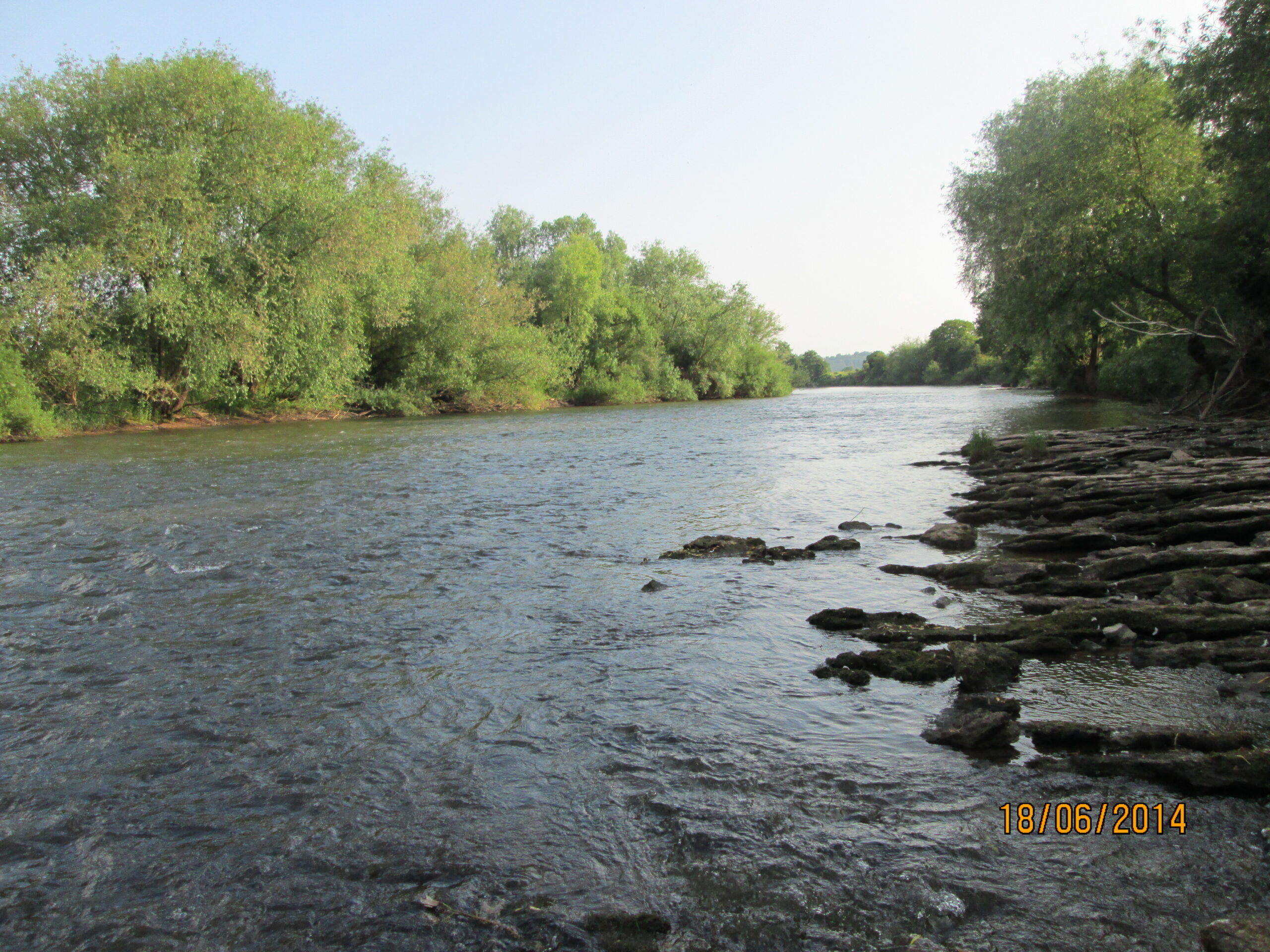
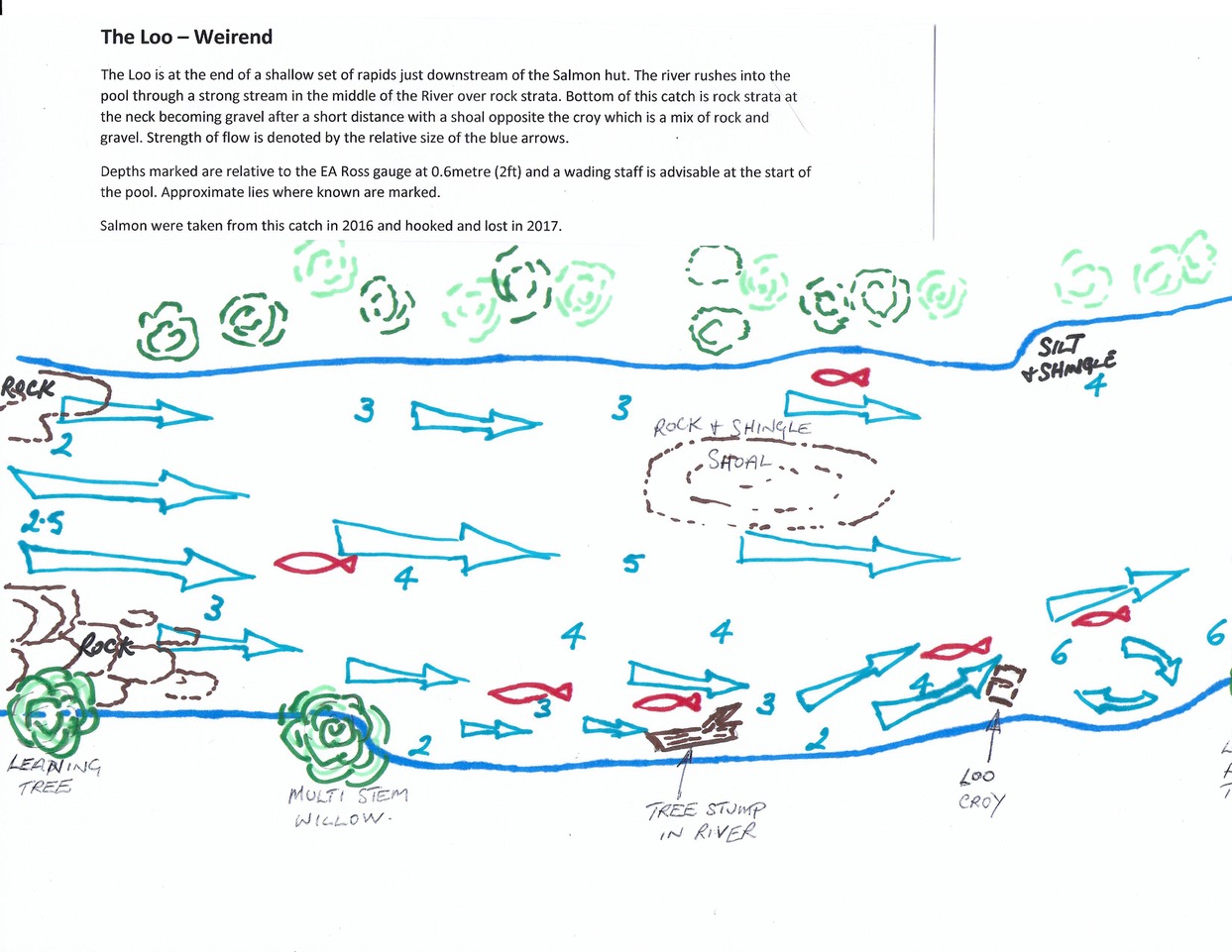
“The Loo is the first of the catches in what is called Jackson’s meadow, the first field after the concrete road. “The Loo” is called by that name as in the past a chemical toilet stood here for the convenience of the Salmon fishers in the days when the Fishing was owned by Guy’s Hospital in London. The Loo can best be described in two parts, at the top of The Loo the water rushes in from the shallows above over sheet rock into the pool and calms into an even flow. Water in the top part of the pool is about 4ft (1.4m) and is a fairly tricky wade (I use a staff). At the bottom part of “The Loo” the water rushes past a small croy into a deep hole which produces fish most years. Fly or Spinning both can score here. The top part of The Loo is wadable down to the croy, the second part is not. The hole here is about 2 plus metres deep, rock and gravel. This catch has produced four fish in the last few years, last one in 2019.
Below is a diagram of the approximate locations of the Salmon lies in The Loo (little red fish). This info has been gained over many years with input from experienced Club members past and present. The strength of the flow is indicated by the size of the blue arrows and I based this on the flow at about 2ft(0.6m) on Ross gauge.
 Next catch down is “Lower Loo” which is not wadable and does not often produce fish. It is worth a cast or two. The bottom here is gravel and tackle eating rock! A fish came from this catch in 2016.
Next comes “Watkins”, utterly reliable and fish come from here every year recently. This catch is one of those where the anglers can get in the water and fish with Fly or Spinner from behind the croy which starts to uncover at about 0.5 metres on Ross gauge. The bottom here is gravel beyond the croy. The catch has produced 13 salmon over the last few years; 1 x2015, 5x 2016, 3 x 2017, 2 x 2018, 1 x 2020, 1 x 2021.
Downstream beyond “Watkins” is “Ray’s” crib, here again mainly fished from the bank but it is possible to wade behind the croy for cover when the Ross gauge measure 0.4 metres or less. The bottom is mainly gravel with some rock. Good flow past this croy and often produces fish in the swirls downstream. Salmon came from this catch in 2015, 2017 and 2019.
At the bottom end of Jackson’s meadow is “The Brook” this again is a reliable catch producing fish most years. Here is our biggest croy which starts to uncover around the 0.5 metre mark on Ross gauge. We capped this croy with concrete in around 2006 so anglers can stand on it, however it is best fished standing in the water behind the croy for stealth. The River here is quite fast as it races by the croy into a substantial pool and can be holding water in summer. Bottom mainly gravel but there is some rock. Another reliable catch fished with fly and spinning and produces to both most years. Fish have come from “The Brook” as follows 1 x 2015, 3 x 2016, 1 x 2017, 2 x2018,
Over the wooden bridge and into the arable field is “Lower Brook”. Here the angler is at the very bottom of the pool mentioned above at “The Brook”. Very interesting catch here, in the middle of the River is a big bump which forces the River to divide with deep channels running both sides of the River and the middle is turbulent running over the gravel bank. Fish are found in the deep water at the sides and behind the gravel bank in the middle. The Club members have only recently worked on this catch to open it up again but it has produced fish in the last few years. There are steps and ladders and further down access ropes to get down the bank to fish. Fish in the middle of the River behind the gravel bump and in the side channels. Considerable work is currently required here( April 2024) to gain access to the River. High flows, erosion and bankside bushes have seriously reduced accessibility.
Next catch downstream is “The Flats”, access was opened by members in 2020 to fish again after many years of laying unfished. Looking at our records there were many salmon caught at this location in the past. It has yet to produce in its latest iteration.
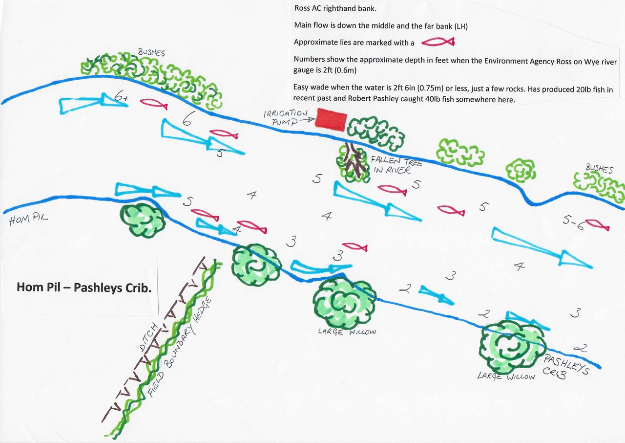
“Hom Pil” catch is next. This is a very famous catch, and was where Robert Pashley caught some of his 40lb salmon in the past. The bottom is mainly gravel but does have some rock and deep holes in the middle of the River. Fish can be seen every year in Hom Pil and it is a good indicator of the stock of salmon in our sections of the River. Easy wade for the most part but be aware of the rock ending suddenly. Can be fished off the bank early season when the water is too deep to wade and wading can be undertaken when the Ross gauge is 0.8 metres or less. There is a ladder for access to the very top of the catch. Wading is possible further down this catch opposite the abstraction pump which operates during the late spring, from here it is possible to wade all the way down to the next catch. Since 2015 a total of 16 salmon have been taken from different parts of Hom Pil . We had 3 x 2015, 1 x 2016, 4 x 2017, 3 x 2018, 2 x 2019, 1 x 2020 and 2 x2022 of 25lb and 20lb. Of these 8 have weighed in excess of 20lb.
Below is a diagram of the approximate locations of the Salmon lies in Hom Pil (little red fish). This info has been gained over many years with input from experienced Club members past and present. The strength of the flow is indicated by the size of the blue arrows and I based this on the flow at about 2ft(0.6m) on Ross gauge.
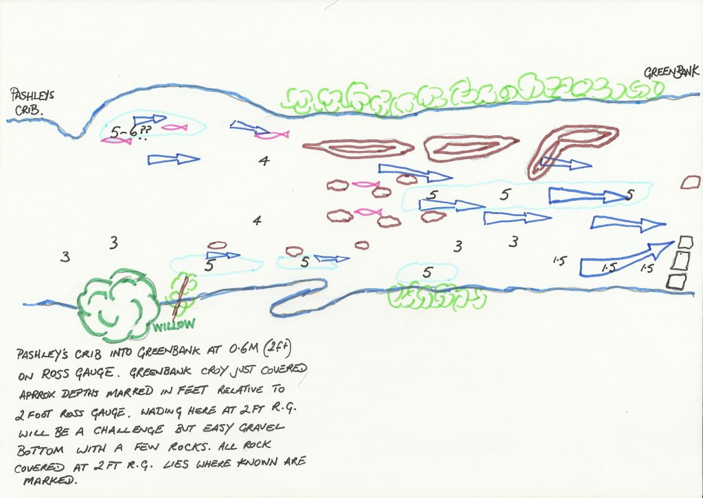
 “Pashley’s Crib” and “Greenbank” I’ll deal with as one. Greenbank is in effect a continuation of Pashley’s both have a gravel bottom which is featureless but does produce the occasional salmon. At the end of Greenbank the River shallows quickly as it rushes over a couple of rock shelves. The water here is much more streamy with normally an abundance of water crowsfoot which can affect fishing the catch. Best to fish it early season. There is now a fallen tree where a stream enters the River. We are going to leave this in place it now provides a useful piece of structure for fish both coarse and game to hide behind (The tree was swept away in the winter of 23/24). Wading is straightforward once the River is down to 0.5 metres on the Ross gauge. Nice place to fish if you only have limited time, best suited to fly fishing. A total of 6 salmon caught in recent years, in 2016, 2017, 2018 and 2019.
Below is a diagram of the approximate locations of the Salmon lies in Pashley’s (little red fish). This info has been gained over many years with input from experienced Club members past and present. The strength of the flow is indicated by the size of the blue arrows and I based this on the flow at about 2ft(0.6m) on Ross gauge.
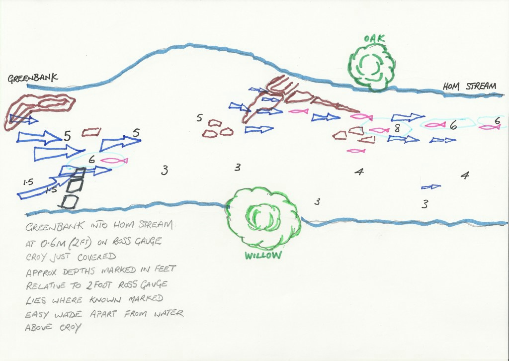
 The next catch down is Hom Stream, this is one of the most productive catches on our Weirend waters. Over recent years it has produced 9 salmon including 6 in 2017. The Wye runs over gravel for the whole length of Hom Stream and the angler can spend a couple of hours fishing it thoroughly. It is approximately 100 yards long and the wading is easy. The Access is straightforward at several access points that exist with blue ropes to help the angler in and out of the water.
Below is a diagram of the approximate locations of the Salmon lies in Hom Stream (little red fish). This info has been gained over many years with input from experienced Club members past and present. The strength of the flow is indicated by the size of the blue arrows and I based this on the flow at about 2ft(0.6m) on Ross gauge.
 Five Trees is the penultimate catch on the way downriver. Club members have fairly recently opened this catch for fishing by cutting back bankside willows. Here the flow is running away from our bank towards the middle of the River making it quite easy to hover flies and artificial baits either whilst wading or from the bank. Mainly gravel bottom with the odd rock the catch can be waded from 0.5 metres on the Ross gauge and lower. There are rock features and a trench in the middle of the River. Salmon often show in this catch both in the middle of the River and on the opposite bank near fallen trees. Past records show salmon came from here but in more recent times fish have been taken in 2017.
The last catch on Ross AC’s water is appropriately called “Bottom Pool”, deeper water here in excess of 2.5 metres in a few places it shallows up into water about a metre deep at the bottom end of the pool as it leaves Ross AC’s waters. The bottom is mainly rock at the run into the pool and gravel at the bottom end. There is one main lie over this rock where every season fish can be seen. This catch does not see many anglers but it can be fished from the bank with spinner and with a little more skill a fly can be put through it. Only opened again for fishing in 2020 it did produce salmon in 2017.
Tactics for Weirend.
The stretch can be fished with fly rod for the most part but, there are certain sections which are better fished using spinning methods. So if the angler is after a full days fishing take both a fly rod and a spinning rod and all the catches can be covered. If like me you like to fish the fly then the middle sections of Weirend can keep your attention for a few hours by fishing Hom Pil, Pashley’s, Greenbank, Hom Stream and Five Trees and ensure concentration is maintained all the way down Hom Stream. For the fly fisher Bann Shrimp, Snaelda and Frances flies have all scored with a sinking or intermediate line early season. If spinning; Mepps fished upstream, Salmo Mors2, Toby and Flying C have all taken fish.
Trevor Hyde.